Historiography: Journal of Indonesian History and Education
| Journal title | : Historiography |
| Sub-title | : Journal of Indonesian History and Education |
| Initials | : JOIN |
| E-ISSN | : 2798-4907 |
| Frequency | : 4 issues per year (January, April, July, and October) |
| Editor-in-chief | : Arif Subekti, S.Pd., M.A. |
| Publisher | : Universitas Negeri Malang with AGSI (Asosiasi Guru Sejarah Indonesia) |
| Indexing | : Garuda | Google Scholar| SINTA 4 |
Historiography: Journal of Indonesian History and Education is a peer-reviewed journal providing an authoritative source of scientific information for researchers and teachers in academia, research institutions, educational institutions, and government agencies. We publish original research papers, conceptual articles, review articles, and case studies focused on history learning and history education as well as related topics. All papers are peer-reviewed by at least two referees. JOIN is published by Universitas Negeri Malang with AGSI (Asosiasi Guru Sejarah Indonesia). This journal managed to be issued four times a year in January, April, July, and October.
From volume 1 issue 3 in 2021 to volume 6 issue 2 in 2026 , this journal has been accredited rank 4 as a scientific journal based on the decree of the Director General of Higher Education, Research and Technology, Ministry of Education, Culture, Research and Technology of the Republic of Indonesia, number 72/E/KPT/2024, dated April 1, 2024.
View Journal | Current Issue | Register
Jurnal Kajian Matematika dan Aplikasinya (JKMA)
 | Jurnal Kajian Matematika dan Aplikasinya (JKMA) is a scientific journal published by Universitas Negeri Malang (UM) since July 2020. The aim of this journal publication is to disseminate research results and new theories that have been achieved in the area of mathematics. Jurnal Kajian Matematika dan Aplikasinya (JKMA) particularly focuses on the main issues in the development of the sciences of mathematics, in the fields of algebra, analysis, applied mathematics, combinatorics, computational sciences, geometry, and statistics. Jurnal Kajian Matematika dan Aplikasinya (JKMA) published two times a year, January and July. This publication is available online via open access. Abstracts and full text that have been published on the website can be read and downloaded in (http://journal2.um.ac.id/index.php/jkma) for free. The manuscript submitted has not been published anywhere both printed or electronic. The author shall refer to the author guidelines before submitting the manuscript. The manuscript submitted will then be evaluated and edited in terms of format, terms used, and other applied styles. The articles published in this journal are written in Bahasa Indonesia or in English. The authors are able to choose their preferred language, between Bahasa Indonesia or English, in the writing of their article. Homepage: http://journal2.um.ac.id/index.php/jkma e-ISSN: 2722-7650 JKMA is indexed by Google Scholar, Indonesia One Search, PKP Index, and Portal Garuda. We plan to register all articles published in JKMA to Crossref at the beginning of 2021 with DOI prefix 10.17977 Please click here to download JKMA's cover. |
View Journal | Current Issue | Register
GENDER DYNAMICS JOURNAL
View Journal | Current Issue | Register
Jurnal Penelitian Tindakan Kelas dan Penelitian Tindakan Sekolah
View Journal | Current Issue | Register
Journal of Disruptive Learning Innovation (JODLI)
Journal of Disruptive Learning Innovation (JODLI) is an academic, open-access journal about concepts, phenomena, and new discoveries that create transformative effects in education based on what the community needs of their time based on three research and development groups, namely: (1) Web / Mobile based Learning Platform with the integration of Artificial Intelligent (2) Ubiquitous Education Technology (u-learning) equipped with Augmented Reality, and (3) Learning management system that utilizes data mining and the power of data analysts. Issues are published biannually (in May and November). Submissions are open year-around and before submitting please ensure that the manuscripts fit within JODLI’s focus and scope, and are written in English and follow our author guidelines. This journal is published by PUIPT Disruptive Learning Innovation Universitas Negeri Malang.
|
|

View Journal | Current Issue | Register
Frontier Energy System and Power Engineering
Journal title | Frontier Energy System and Power Engineering |
Initials | FESPE |
Online | Since 2019 |
Frequency | 2 Issues per Year (January and July) |
Online ISSN | 2720-9598 |
Editor-in-chief | A.N. Afandi, Universitas Negeri Malang, Indonesia |
Managing Editor | Aripriharta, Universitas Negeri Malang, Indonesia |
Publisher | The journal was published by the Department of Electrical Engineering, Universitas Negeri Malang |
Focus & Scope | The FESPE is focused on energy system and power engineering, which is related to advance and develop technology on a wide scope of all partial themes, but not limited, such as: Advanced energy material, Automatic power control, Battery technology, Distributed generation, Distribution system, Electric power generation, Electric vehicle, Electrical machine, Energy optimization, Energy conversion, Energy efficiency, Energy exploitation, Energy exploration, Energy management, Energy mitigation, Energy storage, Energy system, Applied control system, Fault diagnostics, Green energy, Green technology, High voltage, Insulation technology, Intelligent power optimization, Monitoring operation, Motor drives, Natural energy source, Power control, Power data transaction, Power economic, Power electronics, Power engineering, Power generation, Power optimization, Power quality, Power system analysis, Power system information, Power system optimization, Protection system, Renewable energy, SCADA, Security operation, Smart grid, Stability system, Storage system, Transmission system, and etc. |
DOI | prefix |
Indexed | Sinta 4, Google Schoolar, Crossref, Index Copernicus, Garuda. |
Since August 3, 2020, Volume 3 Issue 1 of 2021 through Volume 7 Issue 2 of 2025, FESPE has been accredited (Sinta 4) by KEMENRISTEK/BRIN with SK no. 230/E/KPT/2022. |

View Journal | Current Issue | Register
Jurnal Pengabdian Pendidikan dan Teknologi (JP2T)
| Journal title | : | Jurnal Pengabdian Pendidikan dan Teknologi (JP2T): 2798-0634 |
| Initials | : | JP2T |
| Editor in Chief | : | Yoto , Universitas Negeri Malang, Indonesia |
| Frequency | : | 2 Issues every year (April, October) |
| ISSN (online) | : | 2686-1232 |
| Publisher | : | Universitas Negeri Malang |
| Journal Summary | : | We are proud to announce that the Jurnal Pengabdian Pendidikan Dan Teknologi (JP2T) as a scientific journal. Jurnal Pengabdian Pendidikan Dan Teknologi (JP2T), with registered number E-ISSN 2686-1232 is a multidisciplinary scientific journal published by the Department of Mechanical Engineering, Faculty of Engineering, Universitas Negeri Malang. At the national level which includes many general problems of issues related to community services. The aim of this journal publication is to disseminate conceptual thoughts or ideas and research results that have been achived in the area of Education and Technology to community services. |
View Journal | Current Issue | Register
Jurnal Pendidikan Sejarah Indonesia
| Journal title | : Jurnal Pendidikan Sejarah Indonesia |
| Initials | : JPSI |
| Frequency | : 2 issues per year (June and December) |
| DOI | : prefix 10.17977 by |
| Print ISSN | : - |
| Online ISSN | : 2622-1837 |
| Editor-in-chief | : Dr. Joko Sayono, M.Hum. |
| Publisher | : Universitas Negeri Malang in collaboration with Asosiasi Guru Sejarah Indonesia |
| Indexing | : Sinta | Garuda | Google Scholar | Dimensions | |
Jurnal Pendidikan Sejarah Indonesia or JPSI (e-ISSN: 2622-1837) JPSI is a peer-reviewed journal providing an authoritative source of scientific information for researchers and teachers in academia, research institutions, educational institutions, and government agencies. We publish original research papers, conceptual articles, review articles and case studies focused on history learning and history education as well as related topics. All papers are peer-reviewed by at least two referees. JPSI is published by History Department, Faculty of Social Science, Universitas Negeri Malang in collaboration with the Asosiasi Guru Sejarah Indonesia and managed to be issued twice in every volume (every June and December). JPSI has been accredited as Sinta 3 since Vol. 5 No 1 (2022) until Vol. 9 No 2 (2026).
View Journal | Current Issue | Register
Teknologi dan Kejuruan: Jurnal Teknologi, Kejuruan, dan Pengajarannya
Journal title | Teknologi dan Kejuruan: Jurnal Teknologi, Kejuruan, dan Pengajarannya |
Frequency | 2 Issues per Year (February & September) |
Online ISSN | |
Editor-in-chief | |
Publisher | The journal was published by the Faculty of Engineering, Universitas Negeri Malang, Indonesia |
Focus & Scope | The Teknologi dan Kejuruan: Jurnal Teknologi, Kejuruan, dan Pengajarannya serves to cultivate, disseminate, and archive scholarly research and theoretical developments. The Teknologi dan Kejuruan: Jurnal Teknologi, Kejuruan, dan Pengajarannya publishes manuscripts in a wide variety of research areas in the field of engineering education. This journal published articles containing conceptual ideas, literature review, application of the theory, and book review regarding technological and vocational education in engineering education. We invite relevant reports in the scopes of: Mechanical Engineering Education, Automotive Education, Civil Engineering Education, Construction Engineering Education, Electrical Engineering Education, Informatics Education, Fashion Education, Culinary Education, Tourism Education |
Indexed | DOAJ, Sinta 3, Google Schoolar, Crossref, Garuda, Dimension. |
Teknologi dan Kejuruan: Jurnal Teknologi, Kejuruan, dan Pengajarannya is a peer-reviewed publication published by the Faculty of Engineering, Universitas Negeri Malang, Indonesia. This journal was first published in 1977 under the title "TEKNA." It changed the title to Teknologi dan Kejuruan: Jurnal Teknologi, Kejuruan dan Pengajarannya in 1994 with the aim to become a high-quality international journal. This journal accepts papers from research results, literature review, implementation of educational technology, teaching and learning methods, training from both vocational secondary and high education levels, and training center. It is published twice a year in February and September. Since May 2019, the Ministry of Research, Technology and Higher Education (RistekDikti) Republic of Indonesia accredited this journal with 'Rank 3'. The recognition was issued in the Director Decree no. 14/E/KPT/2019 in 10 May 2019 and valid until 2022. Contact us at [email protected]. Please find the previous website below http://journal.um.ac.id/index.php/teknologi-kejuruan/index. |
View Journal | Current Issue | Register
INSPIJAR: Jurnal Pengembangan Inovasi Pendidikan dan Pembelajaran
INSPIJAR: Jurnal Pengembangan Inovasi Pendidikan dan Pembelajaran published two times a year in July and January. INSPIJAR: Jurnal Pengembangan Inovasi Pendidikan dan Pembelajaran provides scientific papers on education and learning both in Indonesian and English. A paper published in INSPIJAR: Jurnal Pengembangan Inovasi Pendidikan dan Pembelajaran are result of research, conceptual and literature review.
INSPIJAR: Jurnal Pengembangan Inovasi Pendidikan dan Pembelajaran published by UPT Pusat Pengembangan Laboratorium Pendidikan Universitas Negeri Malang State University of Malang. Journal publishing in print (since 2017).
Editors receive a manuscript writing that unpublished in any other media. Writing instructions can be found on the back cover or can be here. Manuscript incoming evaluated by expert editors and or Reviewers. Editors can make changes to the article that was published for the uniformity of format without changing the intent and contents. The author guidelines can be viewed it here, and the paper template can be downloaded here.
View Journal | Current Issue | Register
Jurnal PAUD: Kajian Teori dan Praktik Pendidikan Anak Usia Dini
Dear colleague,
Starting in Vol. 7, No. 3, October 2025, Jurnal PAUD: Kajian Teori dan Praktik Pendidikan Anak Usia Dini move to a new website at https://journal-fip.um.ac.id/index.php/jpaud.
Please do not hesitate to contact us for further information about this.
Once again, thank you for the continuing interest in our work,
Best,
View Journal | Current Issue | Register
Jurnal Ekonomi dan Studi Pembangunan
Jurnal Ekonomi dan Studi Pembangunan (JESP) with registered ISSN 2502-7115 (Online) ISSN 2086-1575 (Print) is published twice a year (April and October) in continuity by Faculty of Economics, Universitas Negeri Malang. It covers the ideas of philosophical, conceptual, theoretical, critical review, and research in the field of development economics and economic development. This journal has registered in crossref system with Digital Object Identifier (DOI) Prefix 10.17977.
JESP has internationally indexed and abstracted in DOAJ, SINTA, EBSCO, Sherpa Romeo, Index Copernicus, Google Scholar, Universal Impact Factor, Directory of Abstract Indexing for Journal, BASE-Bielefeld Academic Reseach Engine, Scholarsteer, Indonesia Publication Index (IPI), Directory of Research Journal Index, Cite Factor, JurnalTOCs, JIFACTOR, Directory of Open Access Scholarly Resources (ROAD), One Search Id, Journal Seek, UNSW Library, Worldcat OCLC, NIU University Libraries, Boston University Libraries, Havard Library, Western Theological Seminary, University of Saskatchewan Library, Moraref, Academic Resources Index, International Scientific Indexing (ISI), JurnalFactor, Scientific Journal Impact Factor, International Innovative Journal Impact Factor (IIJIF), Open Academic Journal Index (OAJI), Cosmos Impact Factor.
Jurnal Ekonomi dan Studi Pembangunan is Nationally Accredited Grade II (SINTA 2) based on the Decree of the Minister of Research, Technology and Higher Education No. 14/E/KPT/2019, May 10th, 2019.
View Journal | Current Issue | Register
Jurnal Ilmu Pendidikan
| Journal title | Jurnal Ilmu Pendidikan |
| Initials | JIP |
| Printed | Since 1994 |
| Online | Since 2011 |
| Frequency | 2 Issues per Year |
| Print ISSN | 0215-9643 |
| Online ISSN | 2442-8655 |
| Editor-in-chief | Hakkun Elmunsyah |
| Managing Editor | Prananda Anugrah |
| Publisher | Universitas Negeri Malang |
| Organizer | Lembaga Penelitian dan Pengapdian Kepada Masyarakat (LPPM) |
| DOI | prefix |
Indexed | DOAJ, Sinta, Google Schoolar, Crossref, ISSN, One Search, MIAR, Garuda, Dimension, Ebsco, WorldCat. |
| Since June 2021, this journal has been accredited Rank 2 (peringkat 2) as a scientific journal under the decree of the Ministry of Education, Culture, Research and Technology of the Republic JIP contains research result acticles and/or critical-analytical study in education field with the purpose to explore, develop, and explain knowledge about design and educational technology, to keep practitioners and researchers informed about current issues and best practice which were writen by authors and LPTK researchers as well as Public and Private IAI/STAI around Indonesia. The author guidelinees can be accessed: Author Guidelines. OAI Address International Journal of Advances in Intelligent Informatics has OAI address: http://journal2.um.ac.id/index.php/jip/oai Before submission You must make sure that your paper is prepared using the JIP paper Template, has been carefully proofread and polished, and conformed to the Author's guidelines. Online Submissions
Registration and login are required to submit items online and to check the status of current submissions. |
View Journal | Current Issue | Register
JABE (JOURNAL OF ACCOUNTING AND BUSINESS EDUCATION)
JABE (JOURNAL OF ACCOUNTING AND BUSINESS EDUCATION), p-ISSN 2528-7281 and e-ISSN 2528-729X is a peer-reviewed and open-access journal published four times yearly (March, June, September, and December). JABE is published by Universitas Negeri Malang (UM), Indonesia, particularly managed by the Department of Accounting, Faculty of Economics and Business, UM with IAI KAPd Jawa Timur, ALJEBI, and APE-LPTK.
JABE aims to help researchers publish their work for a wider audience and discover new connections. JABE publishes articles from the ideas of philosophical, conceptual, theoretical, critical review, and/or empirical research in the field of accounting and business education. JABE exclusively focuses on educational aspects in the business (accounting and financial management) and is inclusive to accounting topics as follows:
- Financial Accounting
- Managerial Accounting
- Public Sector Accounting
- Sharia Accounting
- Auditing
- Forensic Accounting
- Behavioral Accounting
- Taxation
- Capital Markets and Investments
- Accounting for Banking and Insurance
- Accounting for SMEs
- Accounting Information Systems
- Environmental Accounting
- Intellectual Capital
- Corporate Governance
JABE was previously known as Jurnal Pendidikan Akuntansi/JPA (2012-2015). We have been registered in the CrossRef system with Digital Object Identifier (DOI) prefix 10.26675 and has been indexed by DOAJ, Google Scholar, Portal Garuda, Sinta (Science and Technology Index), BASE (Bielefeld Academic Search Engine)
Based on the Decree of the General Director of Higher Education, Research, and Technology Number 0187/E5.3/HM.01.00/2023, JABE was declared as an Accredited Scientific Journal with the category "SINTA 2" from Vol. 7 No. 1 2022 until Vol. 11 No. 2 2026.
View Journal | Current Issue | Register
Jurnal Teknik Mesin dan Pembelajaran
Jurnal Teknik Mesin dan Pembelajaran (JTMP) diterbitkan oleh Departemen Pendidikan Teknik Mesin, Fakultas Teknik, Universitas Negeri Malang (UM). Jurnal diterbitkan secara online (e-jurnal) dengaan nomor registrasi e-ISSN 2623-1271. Jurnal ini diterbitkan dua kali setahun pada bulan Juni dan Desember. Setiap publikasi berisi artikel yang terdiri dari makalah penelitian asli teoritis dan empiris berkualitas tinggi, makalah ulasan, dan tinjauan literatur dalam Bidang Teknik Mesin dan Pembelajaran tentang teknik mesin.
Jurnal Teknik Mesin dan Pembelajaran (JTMP) terakreditasi SINTA 4 mulai voume 1 nomor 1 tahun 2018 sampai volume 5 nomor 2 tahun 2022.
View Journal | Current Issue | Register
Jurnal Praksis dan Dedikasi Sosial (JPDS)
| Journal title | : Jurnal Praksis dan Desikasi Sosial (JPDS) |
| Initials | : JPDS |
| Frequency | : 2 issues per year (April and October) |
| Online ISSN | : 2655-2469 |
| Editor-in-chief | : Sri Untari |
| Publisher | : Faculty of Social Science, Universitas Negeri Malang |
| Indexing | : Google Scholar, Garuda |
Jurnal Praksis dan Dedikasi Sosial (JPDS) are academic peer-reviewed journals and published twice a year, in April and October. This journal provides space for academic debate and critical thinking to explore social sciences and humanities, as well as exploration of problems and social needs. This journal includes articles from research activities in social sciences and humanities such as: civics, laws, history, economics, sociology, geography, anthropology, politics, culture, religion and also educational perspectives such as Citizenship Education, Geography Education, Sociology Education, Economic Education, Historical Education, Anthropological Education, Religious Education, Communication Studies for Educational Needs, Social Studies, and other relevant social sciences.
Since April 2023, this journal has been accredited Rank 3 (peringkat 3) as a scientific journal under the decree of the Ministry of Education, Culture, Research and Technology of the Republic of Indonesia, Decree 152/E/KPT/2023, 25 September 2023.
To make sure that you can receive messages from us, please add the 'http://journal2.um.ac.id' domain to your e-mail 'safe list'. If you do not receive e-mail in your 'inbox', check your 'bulk mail' or 'junk mail' folders.
To see the JPDS Office address on the map, please click on the map below:

No Charges for Processing and Submission.
Announcements
View Journal | Current Issue | Register
Jurnal KARINOV
Dear Esteemed Colleagues,
We would like to inform you that, effective September 20, 2025, the official website of Jurnal Karinov has been migrated to the following address:
https://journals.um.ac.id/index.php/karinov
All future manuscript submissions and journal-related activities are to be conducted exclusively through the new website.
Please be advised that any manuscripts submitted prior to this date via the former website (https://journal2.um.ac.id/index.php/jki) will continue to be processed on that platform until the editorial workflow is concluded.
Should you require any further information or clarification, please do not hesitate to contact us at [email protected]
We sincerely appreciate your understanding and continued support.
Warm regards,
Editorial Office
View Journal | Current Issue | Register
Wahana Sekolah Dasar
|
| ||||||||||||||||
| Journal Summary | : Wahana Sekolah Dasar publishes articles on research, studies and application of theories, practical writing, and conceptual ideas related to Primary Education. The submitted article has never been published in other print / electronic media. The writing format is listed on the Writing Guidelines menu (authors are required to comply with the rules in the Instructions for (Author) Writers). Incoming scripts are evaluated and edited for uniformity of formats, terms and other ordinances. Accountability Article Content The contents of the article and all the consequences of the article are the sole responsibility of the author. Articles that have been published in the Primary School School can be read and downloaded freely by keeping the ethics of scientific publication and copyright / license in Electronic Journal Portal Universitas Negeri Malang (http://journal2.um.ac.id/index.php /wsd). Editor's Address: Jalan Ir. Soekarno 1, Blitar 66112-PGSD FIP Universitas Negeri Malang |


View Journal | Current Issue | Register
Indonesian Journal of Sport and Physical Education
View Journal | Current Issue | Register
JKTP: Jurnal Kajian Teknologi Pendidikan
|
|

JKTP: Jurnal Kajian Teknologi Pendidikan is a journal in the field of educational technology that contains a literature review, action research, case study research, and empirical findings in scientific disciplines of educational technology theories and practices. The covered topics have involved the foundation and philosophy of educational technology, design and implementation, assessment and evaluation, strategies and models of general and specific learning, research and development methods, research and development methods, emerging technologies, and technology integration in learning. Journal of JKTP is willing to facilitate writers to disseminate conceptual ideas, development, and research findings which are useful in the development of science, study programs, and the educational technology profession.
Since August 2022, this journal has been accredited “SINTA 3”(Peringkat 3) as a scientific journal under the decree of the Ministry of Research, Technology, and Higher Education of the Republic of Indonesia, Decree No 230/E/KPT/2022. The certificate can be downloaded here
For the author interested in submitting the manuscript, kindly register yourself. The author guidelines can be viewed it here, and the manuscript template can be downloaded here
Already have a Username/Password for JKTP: Jurnal Kajian Teknologi Pendidikan? go to login
View Journal | Current Issue | Register
JPP (Jurnal Pendidikan dan Pembelajaran)
 | JPP (Jurnal Pendidikan dan Pembelajaran) is published two times a year in April and October. The journal publishes both conceptual and research-based articles within the fields of education in general written in English. JPP (Jurnal Pendidikan dan Pembelajaran) is published by Lembaga Pengembangan Pendidikan dan Pembelajaran, Universitas Negeri Malang in Collaboration with Asosiasi Pendidik dan Pengembang Pendidikan Indonesia (APPI) with ISSN 2302-996X and Electronic ISSN 2580-2313. JPP (Jurnal Pendidikan dan Pembelajaran) has been indexed on DOAJ, Google Scholar, GARUDA, Crossref, Dimensions, and SINTA. Based on the results of the Scientific Journal Accreditation Period I of 2023 and the issuance of the Decree of the Director General of Higher Education, Research and Technology Number 105/E/KPT/2022, dated April 7, 2022, JPP (Jurnal Pendidikan dan Pembelajaran) is listed as the Grade 3 (Sinta 3) journal. |
View Journal | Current Issue | Register
Quantitative Economics Research
Quantitative Economics Research with registered ISSN: 2621-5918 is an International Journal publishes original and high quality applied research orientation in the field of economics that employ theoretical, empirical, and experimental methods. This journal also encourages review articles in particular innovative and fundamental papers that focus on various facets of economics of the emerging market and developing economies.
Quantitative Economics Research is double-blind peer reviewed journal and bi-annually published by Department of Development Economics, Faculty of Economics, Universitas Negeri Malang. Readable, accessible contributions cut through the complex field of economics to make a genuinely valuable contribution to the current understanding of the subject and the development of new ideas. All published articles are made freely available online without subscription charges.
View Journal | Current Issue | Register
JAMP : Jurnal Administrasi dan Manajemen Pendidikan
| Journal title | JAMP : Jurnal Administrasi dan Manajemen Pendidikan |
| Initials | JAMP |
| Frequency | 3 Issues per Year |
| ISSN | 2615-8574 |
| Editor-in-chief | Desi Eri Kusumaningrum |
| Publisher | Universitas Negeri Malang |
Find JAMP on | DOAJ, Sinta, Google Scholar, Garuda |
View Journal | Current Issue | Register
Jurnal Teknik Otomotif : Kajian Keilmuan dan Pengajaran
| Journal title | Jurnal Teknik Otomotif: Kajian Keilmuan dan Pengajaran |
| Initials | JTO |
| Printed | Since 2017 |
| Online | Since 2017 |
| Frequency | 2 Issues per Year |
| Print ISSN | 0613-9324 |
| Online ISSN | 2613-9316 |
| Editor-in-chief | Dianna Ratnawati |
| Publisher | Diterbitkan oleh Program Studi Pendidikan Teknik Otomotif, Jurusan Teknik Mesin, Fakultas Teknik, Universitas Negeri Malang |
| Alamat | Jalan Semarang 5, Malang 65145; Telepon: 0341-565307 |
| Frekuensi Terbit | 2 Nomor/Tahun (April & Oktober) |
| DOI | prefix |
Indexed | Google Schoolar, Garuda, Dimension. |
Jurnal ini diterbitkan oleh Program Studi Pendidikan Teknik Otomotif, Jurusan Teknik Mesin, Fakultas Teknik, Universitas Negeri Malang. Jurnal ini merupakan kumpulan artikel kajian tentang Pendidikan Teknik Otomotif. |

View Journal | Current Issue | Register
International Journal of Insights for Mathematics Teaching
International Journal of Insight for Mathematics Teaching, ISSN: 2615-2495 is published twice a year in March and October. This journal aims to provide insight for mathematics teachers around the world, specifically the corporation of ethnomathematics method into the curriculum and teaching of mathematics. This journal is published by Universitas Negeri Malang and is managed by the Center of Academic Publication of Universitas Negeri Malang. Abstracts and full text that have been published on the website can be read and downloaded in http://journal2.um.ac.id/index.php/ijoimt/index
View Journal | Current Issue | Register
Abdimas Pedagogi: Jurnal Ilmiah Pengabdian kepada Masyarakat
Starting in Vol. 6, No. 2, April 2023, Abdimas Pedagogi: Jurnal Ilmiah Pengabdian kepada Masyarakat move to a new website at http://journal-fip.um.ac.id/index.php/pedagogi.
View Journal | Current Issue | Register
Jurnal Sport Science
Jurnal Sport Science, ISSN :2620-4681 (online), ISSN :1907-5111 (print) diterbitkan oleh jurusan Ilmu Keolahragaan, Fakultas Ilmu Keolahragaan, Universitas Negeri Malang bekerja sama dengan Perkumpulan Program Studi Ilmu Keolahragaan, setiap dua kali dalam setahun, yakni pada bulan Juni dan Desember.
Jurnal Sport Science berisi tulisan yang diangkat dari hasil penelitian di bidang ilmu keolahragaan.
Terbit pertama kali bulan Juni tahun 2006 (cetak).
d.a. Sekretariat Jurnal, Gedung T5 Fakultas Ilmu Keolahragaan, Jalan Veteran Nomor 1.
View Journal | Current Issue | Register
Edcomtech: Jurnal Kajian Teknologi Pendidikan
 | Edcomtech: Jurnal Kajian Teknologi Pendidikan (pISSN: 2548-9879 eISSN: 2599-2139) Edcomtech is a journal in the field of educational technology which contains literature review, action research, case study research and empirical findings in scientific disciplines of educational technology theories and practices. The covered topics are involved the foundation and philosophy of educational technology, design and implementation, assessment and evaluation, strategies and models of general and specific learning, research and development methods, research and development methods, emerging technologies, and technology integration in learning. Journal of Edcomtech is willing to facilitate writers to disseminate conceptual ideas, development, and research findings which are useful in the development of science, study programs, and educational technology profession. Edcomtech was published in collaboration between the Department of Education Technology FIP UM and the Association of Indonesian Educational Technology Study Programs (APS TPI) with MoU and Ikatan Profesi Teknologi Pendidikan Indonesia (IPTPI) with MoU. Since Vol. 6 No. 2 2021 until Vol 11 No. 1 2026, this journal has been accredited Rank 3 (peringkat 3) as a scientific journal under the decree of the Ministry of Education, Culture, Research and Technology of the Republic of Indonesia. For author interested in submitting the manuscript, kindly register yourself. The author guidelines can be viewed it here, and the manuscript template can be downloaded here. Already have a Username/Password for Edcomtech: Jurnal Kajian Teknologi Pendidikan? go to login To make sure that you can receive messages from us, please add the 'http://journal2.um.ac.id' domain to your e-mail 'safe list'. If you do not receive e-mail in your 'inbox', check your 'bulk mail' or 'junk mail' folders. |
| 4 weeks | 8-12 weeks |
| Time to first decision | Review time estimate |
View Journal | Current Issue | Register
Letters in Information Technology Education (LITE)
Journal title Address | Letters in Information Technology Education Published by Electrical Engineering, Universitas Negeri Malang, Indonesia |
Letters in Information Technology Education (LITE), ISNN: 2654-5667 is an open access peer-reviewed international journal that publishes scholarly articles on the teaching and learning about information technology. This includes using technology to enhance learning, to support teaching and teaching administration. In addition, articles with a sound underpinning of pedagogical principles on the teaching of information technology are most welcome. The journal publishes conceptual, theoretical, and empirical papers biannually. This journal is published by Universitas Negeri Malang. |
View Journal | Current Issue | Register
Jurnal Inovasi dan Teknologi Pembelajaran

| Journal title | : Jurnal Inovasi dan Teknologi Pembelajaran |
| Initials | : JINOTEP |
| First published | : 2014 |
| Editor in chief | : Saida Ulfa, M.Edu, Ph.D. |
| Managing Editor | : Ence Surahman, S.Pd., M.Pd., Ph.D. |
| Online ISSN | : 2654-7953 |
| Print ISSN | : 2406-8780 |
| Scope | : See Scope |
| Business Model | : Blind Review |
| License | : CC-BY-SA |
| Citation Analysis | : Scopus | Dimensions | Google Scholar | Sinta |
| Metrics | : Authors Diversity | Visitors Statistics |
| DOI Prefix | : 10.17977 by |
| Publisher | : Universitas Negeri Malang in Collaboration with Asosiasi Program Studi Teknologi Pendidikan Indonesia (APS TPI) and Ikatan Profesi Teknologi Pendidikan Indonesia (IPTPI) with MoU. |
| Frequency | : 3 issues per year: March, July, and November |
| Indexed | : Sinta 3, DOAJ, Google Schoolar, Garuda, Dimension, Crossref, ROAD, BASE, ResearchGate, PKP Index, Neliti, Infobase, Worldcat and ASCI. |
| About JINOTEP | : Welcome to JINOTEP. Jurnal Inovasi dan Teknologi Pembelajaran is a peer-reviewed journal that covers the entire spectrum of innovative educational technology applications, including the design, development, utilization, management, and evaluation to solve learning problems and knowledge exchange. The journal welcomes a variety of approaches to empirical research (qualitative, quantitative, R&D, and mixed methods), as well as high-quality systematic reviews and meta-analyses. Jurnal Inovasi dan Teknologi Pembelajaran is a channel for authors to disseminate their high-quality systematic reviews, meta-analyses, research and development, case studies, and experimental research that are useful in the field of educational and learning technologies. The journal's goal is to serve as a medium for researcher communication as well as a link between researchers, practitioners, and policymakers. This journal registered in the |
| Accreditation Number | |
| Sinta Certificate |
Why publish your manuscript in JINOTEP?
High visibility
The open access policy of JINOTEP ensures that published articles are highly visible and accessible to a wide audience.
Rapidity of dissemination
JINOTEP encourages a streamlined publication schedule while maintaining rigorous peer review; all papers are required to be submitted electronically, and peer review is performed entirely digitally.
Copyright
The copyright for articles published in JINOTEP is held by the authors, and it is in the authors' best interest to allow for reproduction and distribution of their work (additional information is provided in the copyright and license agreement).
For authors interested in submitting the manuscript, kindly register yourself. The author guidelines can be viewed here, and the manuscript template can be downloaded here and here. Already have a Username/Password for Jurnal Inovasi dan Teknologi Pembelajaran? go to login.
| 3-4 weeks | 6-12 weeks |
| From submission to first decision | Review process of the manuscript |
All Issues:
Vol. 11 No. 1 (2024) | Vol. 11 No. 2 (2024) | Vol. 11 No. 3 (2024)
Vol. 10 No. 1 (2023) | Vol. 10 No. 2 (2023) | Vol. 10 No. 2 (2023)
Vol. 9 No. 1 (2022) | Vol. 9 No. 2 (2023) | Vol. 9 No. 3 (2023)
Vol. 8 No. 1 (2021) | Vol. 8 No. 2 (2021) | Vol. 8 No. 3 (2021)
Vol. 7 No. 1 (2020) | Vol. 7 No. 2 (2020)
Vol. 6 No. 1 (2019) | Vol. 6 No. 2 (2020)
Vol. 5 No. 1 (2018) | Vol. 5 No. 2 (2019)
Vol. 4 No. 1 (2017) | Vol. 4 No. 2 (2018)
Vol. 3 No. 1 (2016) | Vol. 3 No. 2 (2017)
Vol. 2 No. 1 (2015) | Vol. 2 No. 2 (2016)
Vol. 1 No. 1 (2014) | Vol. 1 No. 2 (2015)
View Journal | Current Issue | Register
Classroom Action Research Journal (CARJO)
Classroom Action Research Journal (CARJO) with E-ISSN: 2598-4195 is the international academic journal, and is a double-blind, peer-reviewed academic journal publishing high quality conceptual and measure development articles in the areas of classroom action research in economics, accounting, and management. These studies may take the form of action research, design experiments, pedagogical research more generally that is designed to improving the quality of teaching and learning. The objective of the journal is to promote interdisciplinary and cross-national collaboration between groups of teacher educators, educational researchers and schoolteachers.
The Journal is published by Universitas Negeri Malang, Indonesia under management Department of Development Economics, Faculty of Economics. This journal is registered in crossref system with Digital Object Identifier (DOI) Prefix 10.17977 and is indexed/abstracted in Indonesian Publication Index, Base, Crossref, Google Scholar and so forth. Further, the journal will be prepared for inclusion in Scopus and Web of Science.
View Journal | Current Issue | Register
Sekolah Dasar: Kajian Teori dan Praktik Pendidikan
Dear colleague,
Starting in Vol. 33, No. 1, April 2024, Sekolah Dasar: Kajian Teori dan Praktik Pendidikan move to a new website at https://journal-fip.um.ac.id/index.php/sd.
Please do not hesitate to contact us for further information about this.
Once again, thank you for the continuing interest in our work,
Best,
View Journal | Current Issue | Register
Educational Informatics Journal
Educational Informatics Journal is a peer-reviewed journal that provides an international forum for presenting the latest original research results and developments in the fields of educational informatics.
Educational Informatics is a sub-field of informatics. The primary focus is on computer applications, systems and networks that support research in and delivery of education. Educational informatics is based upon information science, computer science and education but particularly addresses the intersection of these broad areas. Note that it is distinct from Informatics Education, a term that relates more to the practice of teaching/learning about informatics, rather than the use of information science and technology in the support of teaching and learning.
Educational Informatics Journal addresses five primary areas of research interests:
- empirical studies, including composing different approaches to teach various subjects, studying availability of various concepts at a given age, measuring knowledge transfer and skills developed, addressing gender issues, etc.
- statistical research on big data related to informatics (computer science) activities including e.g. research on assessment, online teaching, competitions, etc.
- educational engineering focusing mainly on developing high quality original teaching sequences of different informatics (computer science) topics that offer new, successful ways for knowledge transfer and development of computational thinking.
- machine learning of student's behavior including the use of information technology to observe students in the learning process and discovering clusters of their working.
- design and evaluation of educational tools that apply information technology in novel ways.
View Journal | Current Issue | Register
ISLLAC : Journal of Intensive Studies on Language, Literature, Art, and Culture
ISSN: 2597-7385
ISLLAC Journal is an international journal that publishes the best works of intensive research and conceptual studies on language, literature, art, and culture. This Journal is published by Universitas Negeri Malang, and organized by Indonesian Department of Indonesian Literature, Faculty of Letters, Universitas Negeri Malang.
This journal published two times a year (June & December)
The first publication of the journal in 2017, in conjunction with international seminars of language, literature, art, and culture. The international seminar was held in joint partnership between Department of Indonesian Literature, Faculty of Letters, Universitas Negeri Malang with Walailak University, Thailand.
The ISLLAC journal born due to the results of the idea that language, literature, art, and culture have a great role in the development of national character. Many nations in the world are facing issues related to the character of their youth. Many nations' youth began less cultural values that were respected by their community. This fact, especially for developing countries, will lead to problems that could interfere with national development. This issue is a serious problem that needs to be solved.
Every nation has its own language, literature, art, and culture that is used in its activities and daily life. Language, literature, art, and culture have an important role in directing the behavior and building the character of the members of the community.
ISSN : 2597-7385 (media online) - SK no. 0005.25977385/JI.3.1/SK.ISSN/2017.09 - 19 September 2017
🔔 Journal Migration Notice
We would like to inform you that ISLLAC: Journal of Intensive Studies on Language, Literature, Art, and Culture
has been migrated to a new OJS platform.
Starting from the latest issue, all processes of submission, review, and publication are carried out through the following site:
👉
https://journal-sastra.um.ac.id/index.php/isllac/index
Please visit the link above for the latest updates about our journal.
Thank you for your kind attention and cooperation.
Best regards,
Editorial Team of ISLLAC
View Journal | Current Issue | Register
Journal of Mechanical Engineering Science and Technology (JMEST)
| Journal title | Journal of Mechanical Engineering Science and Technology |
| Initials | JMEST |
| Printed | Since 2017 |
| Online | Since 2017 |
| Frequency | 2 Issues per Year (July & November) |
| Print ISSN | 2580-0817 |
| Online ISSN | 2580-2402 |
| Editor-in-chief | Heru Suryanto |
| Managing Editor | Yanuar Rohmat Aji Pradana |
| Publisher | The journal was published by the Department of Mechanical and Industrial Engineering, Faculty of Engineering, Universitas Negeri Malang |
| Focus & Scope | - Advanced Materials and Manufacturing Techniques, including composites, nanomaterials, and alloys and also innovative manufacturing processes: 3D printing, joining, and material modification techniques - Energy Systems and Environmental Sustainability including renewable energy, energy efficiency, and sustainable energy practices: conversion, storage, and utilization of energy from various sources. - Structural Analysis and Mechanical Systems Performance, including structural analysis, design, and performance of mechanical systems and components related to aerospace, automotive, and industrial applications. - Computational Modeling and Simulation in Mechanical Engineering, include advanced computational techniques and simulation tools for the design, analysis, and optimization of mechanical systems and processes. |
| DOI | prefix |
Indexed | DOAJ, Sinta, Google Schoolar, Scilit, Crossref, Garuda, Dimension. |
JMEST has been indexed by Google Scholar since January 2018, DOAJ since 3 March 2018, and accredited in rank 2 (Sinta 2) by KEMENDIKBUD RISTEK with SK no. 72/E/KPT/2024, since vol. 7 no. 1 (2023) to vol. 11 no. 2 (2027). |
View Journal | Current Issue | Register
Preventia : The Indonesian Journal of Public Health
| Journal title | Preventia : The Indonesian Journal of Public Health |
| Initials | PREVENTIA |
| Abbreviation | The Indonesian Journal of Public Health |
| Frequency | 2 issues per year (June & December) |
| DOI | Prefix 10.17997 by  |
| ISSN | 2528-3006 (Print) | 2528-2999 (Online) |
| Editor-in-chief | Tika Dwi Tama |
| Publisher | Universitas Negeri Malang |
| Citation | Sinta | Google Scholar | Garuda |
Preventia: The Indonesian Journal of Public Health ( e-ISSN: 2528-3006 , p-ISSN: 2528-2999 ) is an open access scientific journal published by Department of Public health, Faculty of Sport Science, Universitas Negeri Malang. All articles received in Preventia: The Indonesian Journal of Public Health will be peer-reviewed using a double-blind. Authors who will submit manuscripts please read the following writing instructions.
View Journal | Current Issue | Register
Gelanggang Pendidikan Jasmani Indonesia
Gelanggang Pendidikan Jasmani Indonesia is published by Department of Sports Science, Faculty of Sports Science Universitas Negeri Malang (UM). Gelanggang Pendidikan Jasmani Indonesia is published twice a year in June and December containing articles of research and thought results in the field of Physical Education. First published in January 1990 with the name of GELANGGANG, renamed the Journal of Physical Education in 2014, then renamed the Physical Education in 2017 and last renamed the Gelanggang Pendidikan Jasmani Indonesia in 2018. Learning Domains in Physical Education includes learning plan, learning implementation and learning evaluation. Learning materials of Physical Education consits of 6 category namely: 1) Sports basic science, 2) Motor Activity, 3) Teaching methods and didactic, 4) Assessment, 5) Management, and 6) Blended Learning
Jurusan Pendidikan Jasmani dan Kesehatan,
Fakultas Ilmu Keolahragaan
Universitas Negeri Malang,
d.a. Sekretariat Jurnal FIK UM,
T1 Building.104, Jln. Vetaran No.1 Malang 65145,
Telp. (0341) 551312 psw 479 eks 24.
Website: http://fk.um.ac.id,
E-mail: [email protected].
View Journal | Current Issue | Register
Indonesia Performance Journal
Indonesia Performance Journal with ISSN : 2597-3624 (online) is national scientific journals that are open to seeking innovation, creativity, and novelty. Indonesia Performance Journal is a peer-review journal published by the Departement of Sports Coaching, Universitas Negeri Malang. This journal has the Focus and Scope at presenting and discussing some outstanding contemporary issues dealing with sports.
Indonesia Performance Journal is published every June, and December by Universitas Negeri Malang and accredited by the Indonesian Ministry of Research, Technology and Higher Education (RistekDikti) of the Republic of Indonesia in SINTA (Achieving SINTA 5) since Volume 1 Issue 2 2018. The recognition published in Director Decree (SK No. 36/E/KPT/2019), and it is effective until 2022.
Every submitted manuscript will be read by the editorial team. Manuscripts that are evaluated by editors and deemed not in accordance with criteria of journal will be rejected without external review. Then, a manuscript that has a special interest to readers is sent to peer reviewers, with two (2) different reviewers for each article by using the double blind system. After reviewing the manuscript, it will be returned to the author for revision process. The editorial team makes decisions based on reviewers’ recommendation. This journal provides immediate open access to its content on the principle that making research freely available to the public to supports a greater global exchange of knowledge.
To make sure that you can receive messages from us, please add the 'http://journal2.um.ac.id' domain to your e-mail 'safe list'. If you do not receive e-mail in your 'inbox', check your 'bulk mail' or 'junk mail' folders.
View Journal | Current Issue | Register

JPSE (Journal of Physical Science and Engineering)
|
|


For the author interested in submitting the manuscript, kindly register yourself.
Already have a Username/Password for JPSE (Journal of Physical Science and Engineering)? go to login
View Journal | Current Issue | Register
Journal of ICSAR
|
| ||||||||||||||||
Journal Summary | The Journal of ICSAR is the right place to publish papers in science education, especially in special needs education. The Journal of ICSAR is an innovative, interdisciplinary, comparative, global project in inclusive and special needs education. This journal is organized by the Department of Special Education, Faculty of Education, Universitas Negeri Malang. This journal is expected to serve as a publication media for quality scientific research, especially children's special education, which can be accessed online, printed, and accessible by the people of Indonesia and the international community. The article (article) published in this Journal of ICSAR is an article that has passed or completed the review process by peer-reviewed. Partnership With Southeast Asia Association For Special Education (SAASEd) Klik Here. |


View Journal | Current Issue | Register
International Research-Based Education Journal
| Journal Title | International Research-Based Education Journal |
| ISSN | 2549-6875 (Online) & 2549-1687 (Print) |
| DOI Prefix | 10.17977 |
| Editor in Chief | Burhanuddin |
| Publisher | Faculty of Education Universitas Negeri Malang |
| Frequency | 2 issues per year |
| Citation Analysis | Google Scholar |
International Research-Based Education Journal (IRBEJ) is a peer-reviewed research journal that is published electronically, as open access for everyone. It is derived from educational research findings by researchers who have great commitment to share educational issues through global online publication and open information sharing. This will become one of the reliable spaces for discussions and debates concerning a series of challenging educational issues. The issues could be expanded to specific areas including education science, instructional leadership, educational management, curriculum development, and other related educational services. Therefore, the IRBEJ journal invites researchers, scholars, and professionals to submit original manuscripts on substantial, and unpublished research results in the specified areas.
International Research-Based Education Journal is published by Faculty of Education Universitas Negeri Malang Indonesia. All published journal papers are reviewed and refereed by the international competent researchers, professionals, and scientists. Following standards of international publication guidelines, double-blind international refereeing process is used. Current and previous issues are made available on-line at http://journal2.um.ac.id/index.php/irbej
View Journal | Current Issue | Register
Bahasa dan Seni: Jurnal Bahasa, Sastra, Seni, dan Pengajarannya
 | Bahasa dan Seni: Jurnal Bahasa, Sastra, Seni, dan Pengajarannya is a double-blind peer-reviewed international journal published twice a year in February and August (P-ISSN: 0854-8277) (E-ISSN: 2550-0635). This journal publishes scientific articles on language, literature, art, as well as their relation to teaching. lt publishes empirical and theoretical studies in the form of original research, case studies, research or book reviews, and innovation in teaching and learning with various perspectives. Articles should be written in English.. Bahasa dan Seni: Jurnal Bahasa, Sastra, Seni, dan Pengajarannya are indexed in DOAJ, Google Scholar, EBSCO Open Science Directory, SINTA, ACI with Digital Object Identifier (DOI) Prefix: 10.17977. The manuscript submitted has not been published elsewhere both printed or electronically. The author shall refer to the author guidelines before submitting the manuscript. The manuscript submitted will then be evaluated and edited in terms of format, terms used, and other applied styles. Manuscript Accountability The accountability within manuscript content is the responsibility of the author. The published manuscripts of Bahasa dan Seni: Jurnal Bahasa, Sastra, Seni, dan Pengajarannya should be accessed and downloaded for free from Electronic Journal Portal of Universitas Negeri Malang.
|
View Journal | Current Issue | Register
Journal DaFIna - Journal Deutsch als Fremdsprache in Indonesien
DaFIna Journal or Journal Deutsch als Fremdsprache in Indonesien is an electronic journal run by the German Department, State University of Malang which contains articles both in Indonesian and foreign languages. This journal is published annualy twice in June and December. Articles contained in the form of analysis, study, application of theory, research results and literature review with the scope as follows:
1) DaF (Deutsch als Fremdsprache)/German as a foreign language, especially in Indonesia, but does not rule out similar themes from other countries;
2) Germanistik/German Linguistics and its teaching;
3) Deutsche Literatur/German literature and its teaching;
4) Übersetzung/German translation and its teaching; and
5) Related themes, e.g. a) Tourismus/tourism management for German speaking tourists and its teaching and b) Deutschkurs/management of German courses and its teaching.
Journal DaFIna: Journal Deutsch als Fremdsprache in Indonesien has eISSN 2548-1681. It has been accredited starting from Vol. 1 Issue 1 (2017) up to Vol. 5 Issue 2 (2021).
View Journal | Current Issue | Register

BASINDO : jurnal kajian bahasa, sastra Indonesia, dan pembelajarannya
BASINDO: Jurnal Kajian Bahasa, Sastra Indonesia, dan Pembelajarannya is published by Indonesian Language and Literature Education Study Program (PS-PBSI) as well as Indonesian Language and Literature Study Program (PS-BSI), Department of Indonesian Literature, Faculty of Letters, Universitas Negeri Malang (UM).
BASINDO: Jurnal Kajian Bahasa, Sastra Indonesia, dan Pembelajarannya is published 2 (two) times a year in June (January-June edition) and December (July-December edition), contains articles/articles of thought and research written by experts, scientists, practitioners, and reviewers/reviewers on research results, conceptual ideas, study and application of theory, literature review, and book reviews.
🔔 Journal Migration Notice
We would like to inform you that BASINDO: Jurnal Kajian Bahasa, Sastra Indonesia, dan Pembelajarannya
has been migrated to a new OJS platform.
Starting from the latest issue, all processes of submission, review, and publication are carried out through the following site:
👉
https://journal-sastra.um.ac.id/index.php/basindo/index
Please visit the link above for the latest updates about our journal.
Thank you for your kind attention and cooperation.
Best regards,
Editorial Team of BASINDO
View Journal | Current Issue | Register
JADECS (Journal of Art, Design, Art Education & Cultural Studies)
| Journal Title | : | JADECS (Journal of Arts, Design, Art Education and Culture Studies) |
| Initials | : | JADECS |
| Frequency | : | 2 issues per year (April and November) |
| DOI | : | 10.17977 |
| Online ISSN | : | 2548-6543 |
| Editor In Chief | : | Prof. Dr. Ponimin, M.Hum |
| Publisher | : | Universitas Negeri Malang |
| Indexing | : | DOAJ, Google Scholar, Sinta, Garuda |
JADECS (Journal of Arts, Design, Art Education and Culture Studies) contains scientific articles of research, conceptual ideas, assessment, creation, learning, related to art, design, multimedia, and culture.
The published articles prioritize the analysis of the results of the research, including: the results of study or art creation, educational studies and art learning, or socio-cultural studies linked to art, design and multimedia.
Articles can be written in both English and Indonesian, while abstracts must be written in Indonesian and English.
SK e-ISSN 0005.25486543/JI.3.1/SK.ISSN/2016.12
View Journal | Current Issue | Register
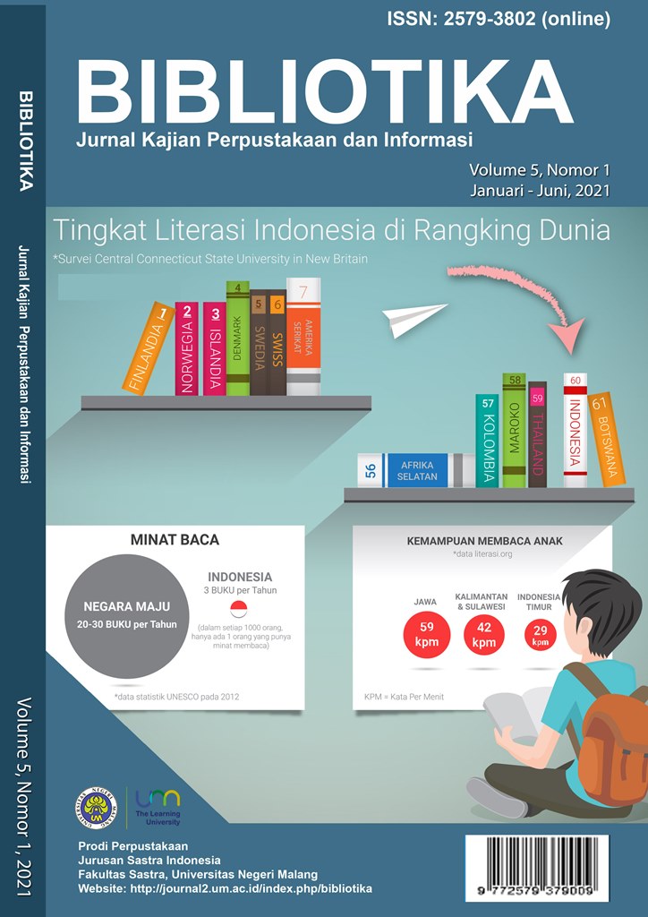
BIBLIOTIKA : Jurnal Kajian Perpustakaan dan Informasi
BIBLIOTIKA : Jurnal Kajian Perpustakaan dan Informasi | ISSN: 2579-3802 is published by Universitas Negeri Malang and organized by Library Study Program, Department of Indonesian Literature, Faculty of Letters, Universitas Negeri Malang.
BIBLIOTIKA : Jurnal Kajian Perpustakaan dan Informasi is published 2 (two) times a year in June (January-June edition) and December (July-December edition), contains articles/articles of thought and research written by experts, scientists, practitioners, and reviewers/reviewers on research results, conceptual ideas, study and application of theory, literature review, and book reviews.
ISSN : 2579-3802 (media online) - SK no. 0005.25793802/JI.3.1/SK.ISSN/2017.04 - 6 April 2017
OAI Address
International Journal of Advances in Intelligent Informatics has OAI address: http://journal2.um.ac.id/index.php/bibliotika/oai
This journal has been accredited Rank 4 (peringkat 4) as a scientific journal under the decree of the Ministry of Education, Culture, Research, and Technology of the Republic of Indonesia (Valid until Vol. 9 No. 2 2025)
Before submission
You must make sure that your paper is prepared using the BIBLIOTIKA Article Template, has been carefully proofread and polished, and conformed to the Author's guidelines.
Online Submissions
- Already have a Username/Password for International Journal of Advances in Intelligent Informatics? Go To Login
- Need a Username/Password? Go To Registration
- Registration and login are required to submit items online and to check the status of current submissions

🔔 Journal Migration Notice
We would like to inform you that BIBLIOTIKA: Jurnal Kajian Perpustakaan dan Informasi,
has been migrated to a new OJS platform.
Starting from the latest issue, all processes of submission, review, and publication are carried out through the following site:
👉
https://journal-sastra.um.ac.id/index.php/bibliotika/
Please visit the link above for the latest updates about our journal.
Thank you for your kind attention and cooperation.
Best regards,
Editorial Team of BIBLIOTIKA
View Journal | Current Issue | Register
Jurnal Ilmiah Bahasa Indonesia bagi Penutur Asing
View Journal | Current Issue | Register
PROCEEDING SEMINAR DAN LOKAKARYA NASIONAL BIMBINGAN DAN KONSELING 2017
PROCEEDING SEMINAR DAN LOKAKARYA NASIONAL REVITALISASI LABORATORIUM DAN JURNAL ILMIAH DALAM IMPLEMENTASI KURIKULUM BIMBINGAN DAN KONSELING BERBASIS KKNI
View Journal | Current Issue | Register
Jurnal Pendidikan Biologi
Dear colleague,
Starting in Vol. 16 No. 2 (2025), Jurnal Pendidikan Biologi move to a new website at https://journal-fip.um.ac.id/index.php/jpb.
Please do not hesitate to contact us for further information about this.
Once again, thank you for the continuing interest in our work,
Best,
View Journal | Current Issue | Register
Jurnal Penelitian dan Pengembangan Pendidikan Luar Biasa
|
| ||||||||||||||||
| Journal Summary | : This journal is expected to serve as a publication media for the results of quality scientific research, especially the special education of children, which can be accessed online, printed and free by the people of Indonesia and the international community. The article (article) published in this Jurnal Penelitian dan Pengembangan Pendidikan Luar Biasa is an article that has passed or completed the review process by peer-reviewed Abstracts and full text that have been published on the website can be read and downloaded for free. The author guidelines can be viewed it here, and the manuscript template can be downloaded here. For author interested in submitting the manuscript, kindly register yourself. Already have a Username/Password for Jurnal Penelitian dan Pengembangan Pendidikan Luar Biasa? go to login. |


View Journal | Current Issue | Register
Jurnal ORTOPEDAGOGIA
|
| ||||||||||||||||
| Journal Summary | : This journal is expected to serve as a publication media for the results of quality scientific research, especially the special education of children, which can be accessed online, printed and free by the people of Indonesia and the international community. The article (article) published in this Jurnal ORTOPEDAGOGIA is an article that has passed or completed the review process by peer-reviewed. Abstracts and full text that have been published on the website can be read and downloaded for free. The author guidelines can be viewed it here, and the manuscript template can be downloaded here. For author interested in submitting the manuscript, kindly register yourself. Already have a Username/Password for Jurnal ORTOPEDAGOGIA? go to login. |


View Journal | Current Issue | Register
Jurnal Riset Pendidikan Fisika
Jurnal Riset Pendidikan Fisika merupakan kelanjutan dari Jurnal Foton: Fisika dan Pembelajarannya, yang dikelola oleh Jurusan Fisika FMIPA Universitas Negeri Malang. Jurnal Riset Pendidikan Fisika berisi tulisan ilmiah tentang gagasan konseptual bidang fisika, hasil penelitian, kajian pustaka, analisis dan aplikasi teori, resensi buku, dan pengajaran fisika. Jurnal ini terbit dua kali dalam setahun pada bulan Mei dan November.
View Journal | Current Issue | Register
JC-T (Journal Cis-Trans): Jurnal Kimia dan Terapannya
JC-T (Journal Cis-Trans): Jurnal Kimia dan Terapannya
Journal title | : JC-T (Journal Cis-Trans): Jurnal Kimia dan Terapannya | |
Initials | : JC-T | |
Abbreviation | : Journal Cis-Trans | |
Frequency | : 2 issues per year (June and December) | |
DOI | : prefix 10.17977 | |
ISSN | : 2549-6573 (Online)
| |
| : [email protected] | ||
Publisher | : Universitas Negeri Malang | |
Indexed | ||
Akreditation | : Sinta 4 (Vol. 1 No. 1 2017 until Vol. 5 No. 2 2022) |
JC-T (Journal Cis-Trans): Jurnal Kimia dan Terapannya was published since Mei 1, 2017 by the Department of Chemistry, Faculty of Mathematics and Natural Sciences, Universitas Negeri Malang.
Journal Cis-Trans published twice a year in Indonesian or English. Journal Cis-Trans publishes an original paper on a multidisciplinary topic in Chemistry (inorganic, physical, organic, analytical, and biochemistry) and applied chemistry (catalyst, catalysis, computational study, materials, nanoscale chemistry, and energy).
This journal registered in the system with Digital Object Identifier (DOI) prefix 10.17977
To make sure that you can receive messages from us, please add the 'http://journal2.um.ac.id' domain to your e-mail 'safe list'. If you do not receive e-mail in your 'inbox', check your 'bulk mail' or 'junk mail' folders.
View Journal | Current Issue | Register
Jurnal Kajian Pembelajaran Matematika
| Journal title | : | Jurnal Kajian Pembelajaran Matematika |
| Initials | : | JKPM |
| : | jkpm.journal@um.ac.id | |
| Frecuency | : | 2 Issues per year (April and October) |
| DOI | : | Prefix 10.17977 by |
| Online ISSN | : | 2549-8584 |
| Editor-in-Chief | : | Abd Qohar |
| Managing Editor | : | Imam Rofiki |
| Publisher | : | Universitas Negeri Malang |
| Indexing | : | Google Scholar, Crossref, Dimensions, Garuda, Sinta, and Index Copernicus. |
Jurnal Kajian Pembelajaran Matematika, number e-ISSN: 2549-8584 (online), is a scientific journal published by Universitas Negeri Malang (UM) since April 2017. It has been indexed by Sinta 4. The aim of this journal publication is to disseminate research results and new theories that have been achieved in the area of mathematics education.
Jurnal Kajian Pembelajaran Matematika, particularly focuses on the main issues in the development of the sciences of mathematics education. Jurnal Kajian Pembelajaran Matematika published two times a year, April and October. It contains scientific articles written in English or Bahasa Indonesia. This publication is available online via open access. Abstracts and full text that have been published on the website can be read and downloaded in (http://journal2.um.ac.id/index.php/jkpm) for free.
The manuscript submitted has not been published anywhere both printed or electronic. The author shall refer to the author guidelines before submitting the manuscript. The manuscript submitted will then be evaluated and edited in terms of format, terms used, and other applied styles.
------------------------------------------------------------------------------
Publisher:
Universitas Negeri Malang
Address : Gedung B24 lantai 2. Jl. Semarang No.5 Malang 65145.
Homepage : http://journal2.um.ac.id/index.php/jkpm
E-mail: [email protected]
View Journal | Current Issue | Register
J-PEK (Jurnal Pembelajaran Kimia)
| J-PEK, Jurnal Pembelajaran Kimia (e-ISSN: 2579-5945; p-ISSN: 2528-6536) is published by Universitas Negeri Malang. The publishing frequency of the journal is two issues per year (June and December), and it welcomes articles (in English) in the area of chemistry education, including research results, reviews or short communication, conceptual ideas in chemistry education, and others in-depth analysis of relevant issues in chemistry education disciplines. J-PEK also accommodate paper describing how chemistry and its application is introduced to society. Editorial address: email: [email protected] |

View Journal | Current Issue | Register
TEKNO: Jurnal Teknologi Elektro dan Kejuruan
TEKNO : Jurnal Teknologi Elektro dan Kejuruan (ISSN: 1693-8739 / 2686-4657) is a national journal providing authoritative source of scientific information for researchers and engineers in academia, research institutions, government agencies, and industries. We publish original research papers, review articles and case studies focused on electrical engineering, informatics, and vocational education as well as related topics. All papers are peer-reviewed by at least two referees. TEKNO is published and imprinted by Department of Electrical Engineering in State University of Malang and managed to be issued twice in every year.
TEKNO : Jurnal Teknologi Elektro dan Kejuruan (ISSN: 1693-8739 / 2686-4657) adalah jurnal nasional yang menyediakan sumber otoritatif informasi ilmiah bagi para peneliti dan insinyur di kalangan akademisi, lembaga penelitian, lembaga pemerintah, dan industri. Kami menerbitkan makalah penelitian asli, artikel review dan studi kasus difokuskan pada teknik elektro, informatika, dan pendidikan kejuruan serta topik terkait. Semua makalah melalui proses peer-review oleh setidaknya dua reviewer.
Jurnal Ilmiah TEKNO diterbitkan dua kali dalam setahun, yaitu pada bulan Maret dan September. Redaksi menerima artikel hasil penelitian atau analisis konseptual. Redaksi sepenuhnya berhak menentukan suatu artikel layak/tidak dimuat dan berhak memperbaiki tulisan selama tidak merubah isi dan maksud tulisan. Naskah yang tidak dimuat, tidak dikembalikan dan setiap artikel yang dimuat akan dikenai biaya cetak.
Sebelum Volume 27 (Tahun 2017), Seluruh Terbitan Online ditampilkan pada situs ini (http://journal.um.ac.id/index.php/tekno)

View Journal | Current Issue | Register
JURNAL TEKNIK MESIN
Jurnal Teknik Mesin diterbitkan oleh Jurusan Teknik Mesin Fakultas Teknik Universitas Negeri Malang (UM).
Jurnal Teknik Mesin terbit 2 (dua) kali setahun pada bulan April dan Oktober, berisi tulisan/artikel hasil pemikiran dan hasil penelitian yang ditulis oleh para pakar, ilmuwan, praktisi, dan pengkaji dalam disiplin ilmu kependidikan dan pembelajaran khususnya di bidang pendidikan teknik mesin dan otomotif.
View Journal | Current Issue | Register
Jurnal Teori dan Praksis Pembelajaran IPS
| Journal Title | : Jurnal Teori dan Praksis Pembelajaran IPS |
| Initials | : JTP2IPS |
| Frequency | : 2 issues per year (April and October) |
| DOI | : prefix 10.17977 by |
| Print ISSN | : 2503-1201 |
| Online ISSN | : 2503-5347 |
| Editor-in-chief | : Idris |
| Publisher | : Prodi Pendidikan IPS, Fakultas Ilmu Sosial, Universitas Negeri Malang |
| Indexing | : DOAJ| Google Scholar| SINTA | Dimensions | Copernicus |
Jurnal Teori dan Praksis Pembelajaran IPS (JTP2IPS, P-ISSN: 2503-1201 and E-ISSN: 2503-5347) is an academic peer-reviewed journal and published twice a year, April and October. This Journal provides space for academic debate and critical thinking to explore social studies learning. This Journal covers original research articles, review articles, and short papers on the subjects that include but are not limited to social studies education, learning media issues in social studies, learning model issues in Social studies, innovation in social studies learning, Integrated technology in social studies, current issue in social studies, and other related subjects.
Since July 2023, we charge a fee for publishing articles in our Journal. Article publication charges will be provided with further information.
View Journal | Current Issue | Register
Jurnal Ilmiah Pendidikan Pancasila dan Kewarganegaraan
Jurnal Ilmiah Pendidikan Pancasila dan Kewarganegaraan (P-ISSN: 2528-0767 and E-ISSN: 2527-8495) contains research articles. Published periodically three times a year in March, July, and November.
Jurnal Pendidikan Pancasila dan Kewarganegaraan is published by Universitas Negeri Malang in cooperation with the Asosiasi Profesi Pendidikan Pancasila dan Kewarganegaraan (AP3KnI).
This journal has been ACCREDITED by National Journal Accreditation (ARJUNA) Managed by Ministry of Research and Technology, Republic Indonesia with Second Grade (Sinta 2) since year 2020 to 2024 according to the decree Nomor 200/E/KPT/2020.
View Journal | Current Issue | Register
Jurnal Pendidikan Nonformal
Dear colleague,
Starting in Vol. 20 No. 1 (2025), Jurnal Pendidikan Nonformal move to a new website at https://journal-fip.um.ac.id/index.php/jpn.
Please do not hesitate to contact us for further information about this.
Once again, thank you for the continuing interest in our work,
Best,
View Journal | Current Issue | Register
Jurnal Sosiologi Pendidikan Humanis
| Journal title | : Jurnal Sosiologi Pendidikan Humanis |
| Initials | : JSPH |
| Frequency | : 2 issues per year (July and December) |
| DOI | : prefix 10.17977 by |
| Print ISSN | : 2502-7875 |
| Online ISSN | : 2527-5879 |
| Publisher | : Faculty of Social Science, Universitas Negeri Malang |
| In Collaboration | : APSSI, AP3SI, APPSANTI |
| Indexing | : DOAJ| Google Scholar| SINTA | BASE | |
Journal Description | Jurnal Sosiologi Pendidikan Humanis (JSPH) issued by the Department of Sociology, Faculty of Social Sciences, State University of Malang in collaboration with the Perkumpulan Profesi Pendidik dan Peneliti Sosiologi Indonesia (AP3SI). JSPH committed to being a scientific journals, relevant to the development of science, as a reference, especially in the fields of sociology, education and culture. JSPH published twice a year continuously (July and December). JSPH contains the results of research and conceptual ideas that have not been published anywhere. This journal registered in the system with Digital Object Identifier (DOI) prefix 10.17977. To make sure that you can receive messages from us, please add the 'http://journal2.um.ac.id' domain to your e-mail 'safe list'. If you do not receive e-mail in your 'inbox', check your 'bulk mail' or 'junk mail' folders. |
View Journal | Current Issue | Register
JPBM (Jurnal Pendidikan Bisnis dan Manajemen)
ISSN (Online) 2527-905X ISSN (Print) 2461-0828
JPBM (Jurnal Pendidikan Bisnis dan Manajemen) is a peer-reviewed scientific journal published three times a year in July, September, and November. The journal concerns with theoretical and empirical papers on business education, economics education, and management. The journal is published by Faculty of Economics and Business, Universitas Negeri Malang. This journal has registered in crossref system with Digital Object Identifier (DOI) Prefix 10.17977
JPBM (Jurnal Pendidikan Bisnis dan Manajemen) has been indexed and abstracted by DOAJ, SINTA, Crossref, Garuda, Indonesian Publication Index (IPI), Garuda, Dimensions and so forth. Jurnal Pendidikan Bisnis dan Manajemen is Nationally Accredited (SINTA 3) based on the Decree of the Ministry of Education, Culture, Research, and Technology No. 0173/C3/DT.05.00/2025, 21 Maret 2025. The journal is also under consideration for reputable indexation, including Scopus and Web of Science.
NEW WEBSITE Starting from July 2025, the authors who submit to this journal, please follow this link https://journal-fe.um.ac.id/index.php/jpbm
View Journal | Current Issue | Register
Jurnal Akuntansi Aktual
Dear colleague,
Starting in Vol. 12 No. 1 (2025), Jurnal Akuntansi Aktual move to a new website at https://journal-fe.um.ac.id/index.php/jaa.
Please do not hesitate to contact us for further information about this.
Once again, thank you for the continuing interest in our work,
Best,
View Journal | Current Issue | Register
Ekonomi Bisnis
THIS IS THE NEWEST VERSION OF EKONOMI BISNIS' WEBSITE. THE PREVIOUS VERSION (http://journal.um.ac.id/index.php/ekobis/) IS NO LONGER UPDATED DUE TO THE MIGRATION OF DATA TO THIS WEBSITE.
e-ISSN (On-Line) : 2528-0503
p-ISSN (Printed) : 0853-7283
Ekonomi Bisnis is a scientific dan peer-reviewed journal focusing in theoretical and apllied research in Management and Business Economics field. The Journal also accept book reviews in relevant field. It is published three times a year (March, July and November) by Department of Management, Faculty of Economics, Universitas Negeri Malang, Indonesia. Ekonomi Bisnis tries to connecting scholars in Management and Business Economics field.
Ekonomi Bisnis is ACCREDITED by Ministry of Education, Culture, Research and Technology, No 5162/E4/AK.04/2021, December, 2021. Validity period from Vol.25/No.2/2020 to Vol.30/No.1/2025
Ekonomi Bisnis accepted original articles from around the world which is well written in English and also in Bahasa Indonesia and not simultaneously submitted to another journal and conference. The journal is welcome manuscript subscription that provides insights into any specialities in the field of Business Management topics especially in (but not limited to) Human Resource and Personnel Management, Marketing and Sales, Operations Management, Organization Theory, Strategic Management and Leadership, Finance and Banking, Information System&Technology in Business, and Entrepreneurship are highly encouraged. Research in Business Economics (Applied Accounting, Applied Economics, Economics Development, Micro-Small-and Medium Enterprise/MSME Management, etc.) are also welcomed. In addition, book review is also accepted.
EKONOMI BISNIS is indexed by:


![]()


![]()
Regarding to EKONOMI BISNIS publishing, Universitas Negeri Malang is in cooperation with:


View Journal | Current Issue | Register
Al-Arabi: Jurnal Bahasa Arab dan Pengajarannya = Al-Arabi: Journal of Teaching Arabic as a Foreign Language
Al-Arabi: Jurnal Bahasa Arab dan Pengajarannya = Al-Arabi: Journal of Teaching Arabic as a Foreign Language published twice a year (June and December), is a bilingual (Arabic and English), peer-reviewed journal, and specializes in Arabic Education. This journal is published by Universitas Negeri Malang, manage by the Arabic Department, Faculty of Letters in partnership with IMLA (Association of Arabic Lecturers). Click here to download MoU.
Editors welcome scholars, researchers, and practitioners of Arabic Education around the world to submit scholarly articles to be published through this journal. All articles will be reviewed by experts before being accepted for publication. Each author is solely responsible for the content of published articles.
Since Vol. 6 No. 1 2022 until Vol 10 No. 2 2026, this journal has been accredited Rank 3 (peringkat 3) as a scientific journal under the decree of the Ministry of Education, Culture, Research and Technology of the Republic of Indonesia Based on Decree of the Director General of Higher Education, Research and Technology No. 225/E/KPT/2022 (Click here to download the certificate).
E-ISSN: 2541-1500; P-ISSN: 1693-3257
To make sure that you can receive messages from us, please add the 'http://journal2.um.ac.id' domain to your e-mail 'safe list'. If you do not receive e-mail in your 'inbox', check your 'bulk mail' or 'junk mail' folders.
View Journal | Current Issue | Register
J-ELLiT (Journal of English Language, Literature, and Teaching)
| Journal title | : Journal of English Language, Literature, and Teaching |
| Initials | : J-ELLiT |
| Frequency | : 2 issues per year (June and Desember) |
| Print ISSN | : 2580-670X |
| Online ISSN | : 2580-9687 |
| Editor-in-chief | : Anik Nunuk Wulyani |
| Publisher | : Faculty of Letters, Universitas Negeri Malang |
J-ELLiT (Journal of English Language, Literature, and Teaching) is a peer-reviewed journal dedicated to promoting the studies of English language, English literature, and English language teaching. It publishes conceptually and/or empirically based studies in those three major fields.
The areas of each field include:
- English language: various levels of linguistic structure, language use, linguistic phenomena, and the teaching of linguistics.
- English literature: literary theory, literary history, literary criticism, comparative literature, world literature, the teaching of literature, and literary translation.
- English language teaching: the teaching and learning of English as a second or foreign language, English language teachers' training and education, and English language teachers’ professional development.
J-ELLiT is published twice a year, June and December, both in print and online. It is managed by the Department of English, Faculty of Letters, Universitas Negeri Malang, Indonesia.
View Journal | Current Issue | Register
Ilmu Pendidikan: Jurnal Kajian Teori dan Praktik Kependidikan
Starting in Vol. 9, No. 1, June 2024, Ilmu Pendidikan : Jurnal Kajian Teori dan Praktik Kependidikan move to a new website at https://journal-fip.um.ac.id/index.php/jktpk.
View Journal | Current Issue | Register
Sejarah dan Budaya: Jurnal Sejarah, Budaya, dan Pengajarannya
| Journal title | : Sejarah dan Budaya : Jurnal Sejarah, Budaya, dan Pengajarannya |
| Initials | : JSB |
| Frequency | : 2 issues per year (June and December) |
| DOI | : prefix 10.17977 by |
| Print ISSN | : 1979-9993 |
| Online ISSN | : 2503-1147 |
| Editor-in-chief | : Indah Wahyu Puji Utami |
| Publisher | : Universitas Negeri Malang in collaboration with Asosiasi Guru Sejarah Indonesia |
| Indexing | : DOAJ | Dimensions| Sinta | Garuda| Google Scholar |
Sejarah dan Budaya: Jurnal Sejarah, Budaya, dan Pengajarannya (ISSN: 1979-9993; e-ISSN: 2503-1147) is published by Universitas Negeri Malang under management of History Department, Faculty of Social Science, in collaboration with Masyarakat Sejarawan Indonesia (MSI), Perkumpulan Program Studi Sejarah Se-Indonesia (PPSI) and Perkumpulan Program Studi Pendidikan Sejarah Se-Indonesia (P3SI). This journal publishes articles about history, culture and its learning twice a year (every June and December).
Since volume 17 issue 1 2023 until volume 21 issue 2 2027, this journal has been accredited Rank 3 (peringkat 3) as a scientific journal under the decree of the Ministry of Education, Culture, Research and Technology of the Republic of Indonesia, certificate number 0547/E5/DT.05.00/2024, May 15, 2024.
View Journal | Current Issue | Register
Jurnal Sains Psikologi
Jurnal Sains Psikologi (JSP) ISSN: 2597-7008 is a scientific journal in Psychology published by Universitas Negeri Malang, Indonesia.
JSP includes topics related to the theme of clinical psychology, industry and organization, education, development, and social. In this journal, we are welcoming any works regarding the problems found in society studied based on Psychology or any form of psychoeducation in various fields of psychology. We encourage author(s) to submit the manuscripts with various study quantitatives methods such as meta-analysis, experimental study, and non-experimental study (correlational, comparison, path analysis, etc).
The JSP is published twice a year, in March and November.
Each article sent to JSP will be reviewed using a double-blind peer review.
View Journal | Current Issue | Register
Jurnal Pembelajaran Sains
View Journal | Current Issue | Register
Jurnal Ilmu Hayat
|
|
J. Ilmu Hayat published by Lembaga Penelitian dan Pengabdian kepada Masyarakat, Universitas Negeri Malang, Indonesia and the Indonesian .... We accept submission from all over the world. Our Editorial Board members are prominent and active international researchers in biosciences fields who ensure efficient, fair, and constructive peer-review process. All accepted articles will be published on free charge and will be freely available to all readers with worldwide visibility and coverage.
J. Ilmu Hayat has been also indexed/registered in
View Journal | Current Issue | Register
JMSP (Jurnal Manajemen dan Supervisi Pendidikan)
Jurnal Manajemen dan Supervisi Pendidikan ISSN 2541-4429 was first published in 2016 by Universitas Negeri Malang.
Published three times a year, March, July, and November.
We accept research articles within the scope of the study of educational management, educational leadership and educational supervision.
View Journal | Current Issue | Register
Jurnal Pendidikan Ekonomi
Jurnal Pendidikan Ekonomi (E-ISSN: 2579-3780) is open access and peer-reviewed Indonesian journal that invites scholars, academicians, professionals, and policy researchers to disseminate their work and knowledge in the area of economic education, business education, and entrepreneurship education in Indonesia and global context. The journal is published by Faculty of Economics and Business, Universitas Negeri Malang. This journal has registered in crossref system with Digital Object Identifier (DOI) Prefix 10.17977/UM014 Jurnal Pendidikan Ekonomi publishes research articles and review papers twice a year (March and October). The journal has been indexed in various national and international indexation, such as Google Scholar, Sinta, Ebsco, Garuda and it is under consideration in DOAJ and Web of Science. In addition, the journal also has been accredited (Sinta 4) as a scientific journal under the decree of the Ministry of Education, Culture, Research and Technology of the Republic of Indonesia. Some advantages of submitting to this journal, including:
|
|

NEW WEBSITE
Starting from August 2025, the authors who submit to this journal, please follow this link
https://journal-fe.um.ac.id/index.php/jpe
View Journal | Current Issue | Register
BANGUNAN
Jurnal BANGUNAN diterbitkan sejak tahun 1994 oleh segenap civitas akademika Jurusan Teknik Sipil Universitas Negeri Malang dengan judul BANGUNAN dengan No. ISSN 0852-2480; e-ISSN 2621-0959. Jurnal Bangunan terbit 2 (dua) kali dalam setahun yaitu pada bulan Maret dan Oktober. Jurnal ini mengkaji gagasan konseptual, teori, praktik, penelitian, dan pengajaran dalam bidang Teknik Sipil dan Teknik Bangunan.
Penyunting menerima sumbangan tulisan yang belum pernah diterbitkan dalam media cetak lain. Naskah yang masuk dievaluasi oleh Penyunting Ahli dan/atau Peninjau Ahli. Penyunting dapat melakukan perubahan pada tulisan yang dimuat untuk keseragaman format, tanpa mengubah maksud dan isinya.
Alamat Penyunting: Jurusan Teknik Sipil Fakultas Teknik Universitas Negeri Malang Gedung G3 lt. 1, Telpon (0341) 551312 psw 297.
Alamat Tata Usaha: Fakultas Teknik Universitas Negeri Malang. Jalan Semarang Nomor 5 Malang 65145, Gedung H5 Lt. I. Telpon (0341) 551312, psw 295. Fax. (0341) 565-307.
E-mail: [email protected] / [email protected]
Alamat website Jurnal Bangunan yang baru : http://journal2.um.ac.id/index.php/bangunan/index, resmi digunakan mulai awal Maret 2018
Jurnal Bangunan telah ditetapkan sebagai Jurnal Ilmiah Terakreditasi Peringkat 5 (SINTA 5) oleh Direktorat Jenderal Pendidikan Tinggi, Riset dan Teknologi. Akreditasi berlaku dari Volume 26 Nomor 2 Tahun 2021 hingga Volume 31 Nomor 1 Tahun 2026.
View Journal | Current Issue | Register
Jurnal Ilmiah Pro Guru
ISSN 2442-2525(cetak)
E_ISSN: 2721-7906(elektrik)
Jurnal Ilmiah Pro Guru menerbitkan artikel hasil penelitian dan non penelitian bidang pendidikan dan pembelajaran. Jurnal Ilmiah Pro Guru diterbitkan oleh Dinas Pendidikan dan Kebudayaan Kota Probolinggo.
Jurnal Ilmiah Pro Guru terbit empat kali setahun pada bulan Januari, April, Juli, dan Oktober
